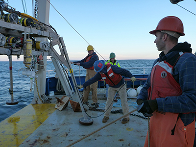
These pages provide access to Oceanographic time-series measurements made by the U.S. Geological Survey between 1975 and the present as part of research programs. The data were collected to address specific research questions and were primarily collected over durations less than a year, using stationary platforms, with sensors near the sea floor. Some of the measurements span the vertical extent of the water column, but others are limited to the area less than 5 meters above the sea floor. These data have been used to study of ocean dynamics and to validate coastal ocean models.
All the sites at which oceanographic or water quality measurements were collected by our program are shown on the interactive map below. Platforms from an Experiment all use the same icon (legend at bottom). Click on the icons to display the Experiment name, platform ID at that site, and the deployment dates. The "Experiment List" tab may also be used to select Experiments. Map Instructions.
Data from Three Recent Studies Released in the USGS Oceanographic Time-Series Data Collection", Montgomery and Sherwood, 2017. USGS Soundwaves, November/December 2017
Data from Three Recent Studies Released in the USGS Oceanographic Time-Series Data Collection", Montgomery and Sherwood, 2017. USGS Soundwaves, January/February 2017
First USGS Coastal Maps from Unmanned Aerial Systems, Sherwood 2016. USGS Soundwaves, June/July 2016
Data from Three Recent Studies Released in the USGS Oceanographic Time-Series Data Collection", Montgomery 2016. USGS Soundwaves, June/July 2016
Updated Website Provides Easy Access to Oceanographic Time-Series Data, Montgomery 2016. USGS Soundwaves June - July 2016
Five New USGS Oceanographic Datasets Published Online—Uses Include Assessing Coastal Resilience to Storms, Montgomery, 2015. USGS Sound Waves, January/February 2015
Instruments Deployed near Martha’s Vineyard, Massachusetts, to Measure Bottom Shear Stress and Other Variables near the Seafloor. USGS Sound Waves, September/October 2014
Update on Oceanographic Study Offshore of Fire Island, New York. USGS Sound Waves, March/April 2014
North Atlantic
 Argo Merchant Experiment
 Barnegat Bay 2014, NJ
 Barnegat Bay, NJ
 Blackwater National Wildlife Refuge
 Buzzards Bay
 Cape Cod Bay ||
  Cape Cod Misc
 Deep Water Dump Site 106
 Ecology of Harmful Algal Blooms I (ECOHAB)
 Ecology of Harmful Algal Blooms II (ECOHAB)
 Fire Island, NY, Nearshore
 Fire Island, NY, Offshore
 Fluxes in West Falmouth Harbor
 Georges Bank
 GLOBEC Georges Bank
 GLOBEC Great South Channel
 Gulf of Maine
 Hudson Shelf Valley
 Hurricane Irene, Buzzards Bay
 Lydonia Canyon
 Mass Bay Long Term Observations (MWRA)
 Mass Bay Circulation
 Mass Bay Internal Wave
 Middle Atlantic Bight
 Martha's Vineyard OASIS 2011
 Martha's Vineyard 2014-2015
 Martha's Vineyard - fall 2015
 New England Continental Slope
 NRPP, 2017
 Oceanographer Canyon
 Rachel Carson National Wildlife Refuge
 Stellwagen Bank
 Sandwich, Massachusetts 2016
 Sandwich, Massachusetts 2017
 Western Gulf of Maine 2013-2017
 Western Massachusetts Bay
 West Falmouth Harbor 2016
 West Falmouth Harbor 2017
South Atlantic
 Cape Hatteras Diamond
 Cape Hatteras Nearshore
 Matanzas Inlet, 2018
 Chincoteague
 Myrtle Beach
 South Atlantic Bight
 Wrightsville Beach
Gulf of Mexico
 Chandeleur ||
  Chandeleur 2013
 Dauphin Islands ||
  Deep Reef
 Grand Bay
 Lake Pontchartrain ||
  Mobile Bay
Pacific CAMP ||
  Farallones
 Karin Ridge
||
 Mamala Bay
 Monterey Bay ||
  Monterey Canyon
 Orange County
 Palos Verdes Shelf
 Palos Verdes Shelf 04
 Palos Verdes Shelf 07
 Southern California
 Southern California Wetlands, 2013 - 2014
 Stress
Europe
 EuroSTRATAFORM