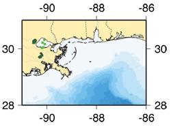
Description: A series of moored array studies to investigate the circulation and particle transport in Lank Pontchartrain. Duration:Mar-Jul 1995; Jan-May 1998 USGS PIs: R. Signell, M. Noble Collaborators: Publications: Field Activity Reports: 1995-026-FA, 1995-046-FA, 1998-005-FA, 1998-030-FA Explore
where measurements were made and the kinds of data
collected during this |
|
Links to the Data |
|
|---|---|
| Basic Sampling Interval | Data access via OPeNDAP |
| Hourly Averaged Data | |


 U.S. Department of the Interior |
U.S. Geological Survey
U.S. Department of the Interior |
U.S. Geological Survey
URL:
Page Contact Information: WHSC Webmaster
Page Last Modified: