|
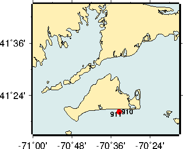
Description: These data were obtained by the U. S. Geological Survey (USGS) as part of the Office of Naval Research (ONR) Optics Acoustics and Stress In Situ (OASIS) Project, funded jointly by ONR and the USGS Coastal and Marine Geology Program as part of the Coastal Model Applications and Field Measurements Project. The objective of the measurements was to relate optical and acoustic properties of suspended particles as wave- and current-induced stresses caused changes in particle size, concentration, and vertical distribution in the bottom boundary layer (bbl) near the seafloor. This information on the physics of particle resuspension and aggregation, and light penetration and water clarity, will help improve models of sediment transport, benthic primary productivity, and underwater visibility. There is a well-established technology for acoustic profiling, but optical profiles are more difficult to obtain because of the rapid attenuation of light in water. A specially modified tripod with a moving arm was designed to move instruments vertically in the bbl, between the bottom and about 2 meters above the bottom. The profiling arm was designed, built, and tested during the spring and summer of 2011 by a team of scientists, engineers, and technicians from the USGS Woods Hole Coastal and Marine Science Center (WHCMSC). To accommodate power requirements and the large data files recorded by some of the optical instruments, the tripod was connected via underwater cable to the Martha's Vineyard Coastal Observatory (MVCO), operated by the Woods Hole Oceanographic Institution (WHOI). This afforded real-time internet communication with the embedded computers aboard the tripod. Instruments were mounted on the profiling arm, and additional instruments were mounted elsewhere on the tripod and nearby on the seafloor. The tripod (USGS Mooring 910) and a small mooring (911) for a profiling current meter were deployed on 17 September at the MVCO 12-m deep underwater node about 2 km south of Martha's Vineyard, Massachusetts. Divers assisted in the deployment and cleaned the instrument surfaces on the tripod approximately once a week until the tripod and current meter were recovered on 23 October, 2011. There was a range of wave and current conditions during the 36-day deployment, including the distant passage of tropical cyclone Ophelia, several moderate wave events, and a significant local gale that generated wave heights greater than 4 m at the 12-m site and knocked over the tripod three days before it was recovered. All but one of the instruments functioned well and provided complete data sets. Duration: Sept.- Oct. 2011 USGS PI: C.R. Sherwood Publications: Sherwood, C.R., Dickhudt, P.J., Martinni, M.A. and Montgomery, E.T., 2012. Profile measurements and data from the 2011 Optics. Acoustics and Stress, In-Situ (OASIS) Project at the Martha's Vineyard Coastal Observatory (MVCO), U.S. Geological Survey Open-File Report 2012-1178. (Available online at http://pubs.usgs.gov/of/2012/1178/). Sherwood, C.R., 2011. Mechanical Arm + Internet = Realtime Profiles of Particles Near the Seafloor. USGS Soundwaves November 2011 Field Activity Reports: 2011-048-FA, 2011-051-FA, 2011-052-FA, 2011-053-FA 2011-054-FA Explore
where measurements were made and the kinds of data
collected during this FGDC metadata for this experiment. |
|
Links to the Data (below): |
|
|---|---|
| Basic Sampling Interval | Data access via THREDDS |


 U.S. Department of the Interior |
U.S. Geological Survey
U.S. Department of the Interior |
U.S. Geological Survey
URL: stellwagen.er.usgs.gov/mvco_11.html
Page Contact Information: WHSC Webmaster
Page Last Modified: Wednesday, 18-Aug-2015 09:56:00 EDT